
Cambodia eTOD Project: Phnom Penh Airport
2019-2020
The surveyed airports were Phnom Penh International Airport (VDPP), Siem Reap International Airport (VDSR) and Sihanoukville International Airport (VDSV). Due to the large scope of this project, the Phnom Penh (VDPP) eTOD survey will be outlined.
Obstacle data collection involved high-resolution satellite imagery acquisition of the aerodrome and its surrounding area, supplemented by GCP surveys for georeferencing and optical ground surveys for the identification of potential obstacle features in the field. This additional ground survey obstacle data was integrated with data extracted from imagery.
eTOD data extraction and terrain analysis was carried out in multiple stages according to ICAO defined aerodrome areas. Final datasets assembled into in a detailed eTOD GIS database for delivery.

We conducted eTOD surveys of several international airports across Cambodia from October 2019 to April 2020 for Cambodia Air Traffic Services (CATS).


-
High resolution satellite imagery was captured over Phnom Penh International Airport in the required eTOD survey areas outlined in ICAO Annex 15, Area 2 (a, b and c). Imagery capture was done through the Airbus DS Geo Pleiades satellite, with technical specifications as follows: 50cm spatial resolution, panchromatic and multispectral spatial and spectral bands, on stereo new collect acquisition mode. Acquisition period was November to December of 2019, covering an area of around 175 sqkm.
Captured imagery was processed for sensor orientation adjustment, automated DSM generation and DTM editing. We produced the following terrain models: a 3m posting digital surface model (DSM) and a 5m posting digital terrain model (DTM) with additional break-lines added to DTM points.
50cm pan sharpened and mosaicked imagery data was also produced, primarily for obstacle data and feature mapping. -
A ground control point (GCP) survey was carried out over October to December 2019 for the purpose of accurately georeferencing satellite imagery captured over Phnom Penh, as well as for DSM and DTM generation.
25 points in total were surveyed, comprising of 10 newly acquired GCP and 15 control points derived from the control survey network (JICA) used for total station surveying. Multiple receivers were used simultaneously where possible for closed loops.
2 SATLAB SNL-600 GNSS base/rovers and one SL 800 rover were deployed, and all GNSS processing and adjustment was done on the Trimble Business Center, compiling all data into a single project using one PACS (primary control station point) provided by CATS and Cambodian civil aviation authorities. Processed data was then assembled in a GIS Database.
-
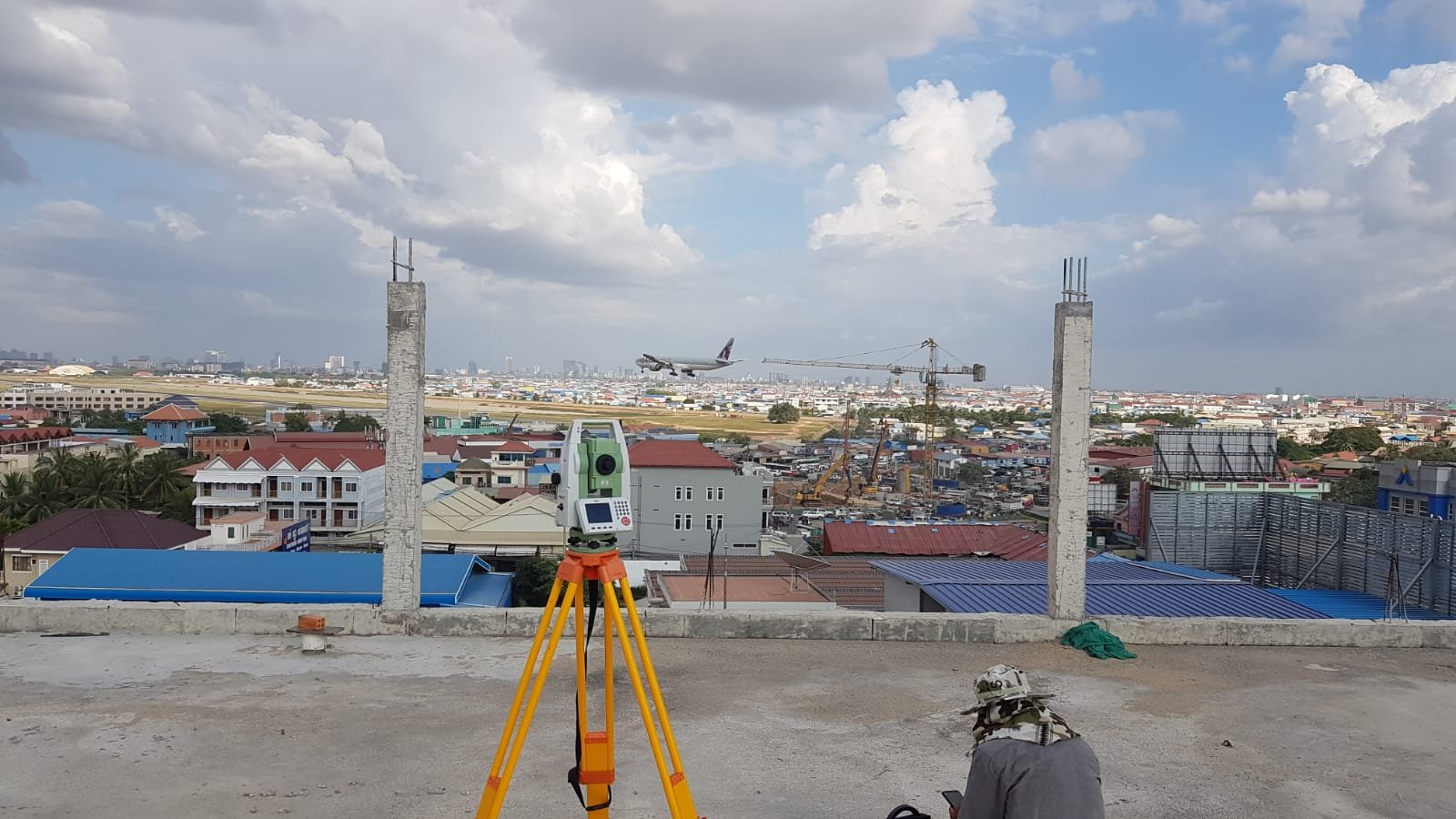
A total station survey was performed for identifying possible obstacle features in the field, surveying for their position, elevation and attribute data. This potential obstacle data was later integrated with obstacle data extracted from acquired satellite imagery.
The Leica TS-09 Reflectorless Total Station was used, able to measure distances without a reflector prism for up to 1000m. Total stations were based in the survey control stations established during the airport control network survey.
Optical surveys of areas adjacent to the aerodrome were carried out to capture more detailed information of obstacle features such as antennae and building eaves, to supplement, improve and verify satellite imagery.
Optical survey points were linked to target photos within the GIS database, with additional digital photography providing a wider field of view of points. Each point was assigned a corresponding eTOD type code, separated into point, line and polygon obstacles according to its attributes.


eTOD Data Extraction
Obstacle Collection Surface (OCS) Generation
Area OCS boundaries and OCS surface heights for each area were calculated according to ICAO Annex 15 guidelines. Individual OCS for areas 2, 3 and 4 were generated and then combined to produce a single obstacle collection surface for the whole project area.
The DSM and OCS were analysed for obstacles, extracting any points on the DSM with a higher elevation than the OCS into a DSM Obstacles GIS layer. This layer was used as a guide to obstacle capture and mapping extracted from captured satellite imagery.
3D photogrammetric stereo mapping was used for data mapping building obstacles.


Obstacle Data Extraction
Obstacle data (points, line and polygons) was extracted from derived DTM and DSMs by terrain analysis software, and extracted data was checked and verified using the 3D photogrammetric stereo mapping method.
Final obstacle data was assembled into an eTOD obstacle database via GIS mapping software, including all attributes, metadata, and the structure necessary to produce AIXM format eTOD.
All datasets were produced in compliance with ICAO specified resolutions and accuracies for Areas 2,3 and 4 in Annex 15.

Phnom Penh 10m Digital Terrain Model (DTM)

Phnom Penh Digital Surface Model (DSM)

Phnom Penh DEM Obstacle Data
